
MapToTrack(TM)
500+
Downloads

Everyone
info

About this app
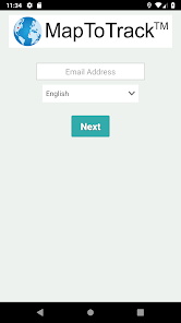
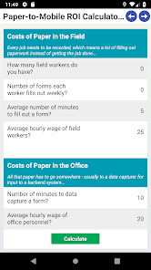
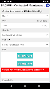
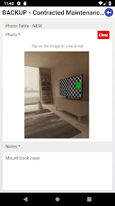
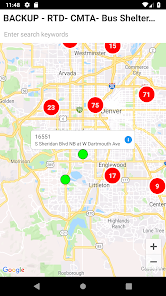
MapToTrack(TM) is a dynamic, activity-based data collection, mapping and analysis cloud platform. We enable business and government organisations to select, collect, map and analyze information in emergency management, critical infrastructure, community structures and asset management and a wide variety of related work. Our web platform allows organisations to collect and connect data according to the type of mapping needed, with support for services such as Google Maps, ESRI ArcGIS Online or CartoDB. The MapToTrack(TM) app is our companion mobile client for accessing our cloud platform on the move and capturing data in the field. Collected data is automatically uploaded when the data collection device has a wireless signal.
Updated on
Safety starts with understanding how developers collect and share your data. Data privacy and security practices may vary based on your use, region, and age. The developer provided this information and may update it over time.

No data shared with third parties
Learn more about how developers declare sharing

No data collected
Learn more about how developers declare collection

Data is encrypted in transit

You can request that data be deleted
What's new
Bug fixes and performance improvements.


